May 6,'08 2 Bar Ridge TH to Frazier TH

We started this ride near Black Brush Ranch . Black Brush Ranch, 2 Bar Ridge TH, and Frazier TH are all on the south side of Roosevelt Lake, between the lake and the Superstition Mountains .

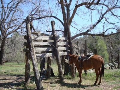
Corral at the gate to Black Brush Ranch


Across from the corrals is the road leading to 2 Bar Ridge TH
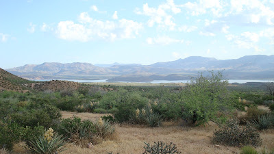


Looking down at the east end of Roosevelt Lake

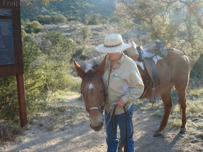
This day's ride would be down-stream through Cottonwood Canyon (I wonder how many Cottonwood Canyons there are in the Southwest. ) which had sustained significant flood damage last year . There was a sign stating that the trail was not recommended for horses . We knew about this warning, so Dick waited for me to call him before he moved camp, in case Billy and I couldn't get through . Billy and I were solo again .


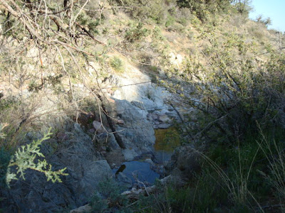
Upper part of Cottonwood Canyon


Yes, there were some difficult places, but a barefoot mule can do difficult things . I did get off a number of times to be safe, and to make it easier for Billy .


Water was flowing and gurgling into small pools . The cottonwoods and the sycamores are tall in this little canyon . And there are grapevines . A cool and quiet place .


middle Cottonwood Canyon


It is a small canyon; the walls are nearly always visable


I love sycamore trees . Have you ever taken one of the leaves and inhaled it's smell? Very distinctive aroma .


I had been in this canyon before, so I knew when we were getting toward the end of the riparian
section . The canyon held one last challenge .

We came to a point on the trail where it dropped straight down off of an undercut bank; about a 3 1/2 to 4 foot dropoff with flood debris at the bottom . No way around it . We had come so far, mastered so many challenges, I didn't want to go back . The stream bed was choked with dead trees, brush, small boulders; no way to get through it .

Pushing and crashing through live and dead brush to the other bank, I scouted that bank for a possible way out, and around this impassable section of creek . It looked like maybe we could do it, if Billy would follow me . I broke down as much brush as I could, and on my hands and knees, got part way up the hillside . The dirt was dry and loose; 2 steps up and 1 back . "Let's try it; Come on Billy !" He came on; sliding sideways downhill; scrambling ..... trying so hard for me !

We got up to a little crest that then went down into the next sidewash . I found a game trail leading back down into the creek . It was very brushy, but do-able . But now we were again faced with a dropoff of 4 feet with flood debris at the base of it . I could see the nice sandy trail about 10 feet out from the base of this bank.

I thought that maybe I could break down the bank enough for Billy to get down if I sat down and slid off the bank , taking as much of it with me as possible . So I did that, and asked Billy to "Come on down!" And he did . Part way down he seemed to realize that his best option was to jump . He sailed past my face and landed in the trail ! And calmly started eating the grass there . I love this mule .

Shortly after that, we were out of the canyon and onto the little Forest Service road leading to the junction with the trail to Frazier TH .


Roosevelt Lake, after leaving Cottonwood Canyon


Another crested saguaro !


close-up


The marina at Roosevelt Lake, as seen from the F.S. road leading to the junction with Frazier TH


Trail leading to Frazier TH


Frazier Horse Camp, across the highway from Frazier TH
Very close to the shore of Roosevelt Lake


Me and my pals
Photo taken by my best pal, Dick
April 24,'08 Superstitions; Rogers Trough to 2 Bar TH

Rogers Trough, where we started this days ride, is on the SE edge of the Superstition Wilderness .
Unknowing that I was starting the toughest ride of the whole trail so far, I started off at 7:15 in the morning, just as the sun was entering the mountains .

We'll sign the trail register and be ready to go .


Here we go, Billy .


Following a creek down from Rogers Trough, the trail was easy to follow but not always easy to get through . There were a number of rocky step/jump downs, and some fairly heavy brush overhanging the trail in places . But the morning was glorious and I was enjoying being out on the trail .


A pool in the creek just down from the trailhead, the morning sun has not quite arrived here .


After turning up Grave Creek the going became a little more difficult, brushier and rockier . There was clear water flowing in the creek and yellow monkey flowers along the banks .

The climb up to Reavis Pass was often narrow, but the brush was so thick that it would have been difficult to fall very far off the trail . I was glad that I was not leading a pack horse as it would have been hard work to drag a wide pack through that brush . At Reavis Pass there were three or four logs in a clearing; just right for sitting on and taking a rest . (How did they get there ?)

The trail down Reavis Creek toward Reavis Ranch was in and out of ponderosa pine and huge alligater juniper; shady and cool . Access to water in many places in the creek kept Billy hydrated and happy .

I got off of Billy at this log . I climbed over and asked him to come along . He hopped right over it . I love this mule .


This huge,huge old juniper is right next to the trail as you enter the meadows near Reavis Ranch.
T


All that remains of the ranch house at Reavis Ranch
A

Remains of a loading chute at Reavis Ranch


Another look at the loading chute

The route of the old road that used to come up to the ranch passes along this old pasture and corral area, as well as along the old orchards . This road is now the trail through this area and on into the ranch house site .

The famous apple orchards at Reavis Ranch

Although these trees are never pruned,as you can see, they still produce fruit and people hike up to the ranch to pick it . The trail up from the north side of the mountains is the old road, so it is easier than the trail from Rogers Trough .

From the meadows at Reavis the AZT turns abruptly east, crossing Reavis Creek for the last time, and angling up a stairstep rock bluff . Then on and on over very rocky trails; to imagine the size of rocks think: size of your fist to size of your head, and then some small boulders . But the scenery was wonderful ! Boulder outcroppings, vistas across small canyons with sycamores in the drainages, yuccas blooming, Indian paintbrush, the scent of pinyon pine warmed by the sun ....

And then at Pine Creek, I came upon a camper. A woman alone who had backpacked in and was planning to stay a few days . Pine creek, on the Arizona Trail, is quite remote ! I stopped and talked to her a little while . She was having some trouble with her knee so she was going to rest another day and then take her last ibuprofin and hike out the next day . I had 3 ibuprofin with me so I gave her 2 of them . We exchanged email addresses and I went on down to the creek to let Billy get a drink before we went on . Somehow in our surprise to see anyone else out there, we each forgot to take any photos !

I was beginning to be concerned about the time, so I did not stop for many more pictures .


Walnut Spring (if you can find the water))

The trail went on and on; over ridges and down into drainages; no more water for Billy . We are now 9 hours into the ride .


Up one side and down the other, over the ridges....... great views down north-facing canyons, Apache Lake to the northwest, now Roosevelt Lake to the northeast........... maybe I'm finally on 2 Bar Ridge ?!..... but it goes on and on ........11 hours into the ride .

I was getting concerned that Billy would get too tired, so I began to "tail" up the hills (hold onto his tail and let him pull me up the hills instead of him carrying me up the hills) and led him down the hills . (After I saw how well he recovered from this days work, I know that he did not need this help .) I also took the bit out of his mouth so that he could more easily grab bites of grass without stopping - it had been a long time since "breakfast" . Steering suffered a bit from this arrangement but we managed to get along alright .

Thank goodness we had the satellite phones so I could call Dick in camp and let him know where I was on an hourly basis . But for some reason I was unable to reach him for 2 hours, and it was getting late in the day, so he called Search and Rescue . I was able to get through to him in the next hour, so he canceled Search and Rescue .
The sun was going down; I was still on 2 Bar Ridge . I was well enough prepared that if I had to spend the night out on the trail I knew that I would be okay......but I would rather not do that .

We came onto an old roadbed traversing a side-hill; must be close now ? Around the side of the hill and YES!, the Wilderness Boundry marker ! But no AZT signs to tell me which of the two road options to take . Sense of direction tells me to go east . " T" into another road; it's almost dark; keep going east . I see a hill I recognize from our scouting of the area and I knew we were going to make it into camp that night .

I called Dick again; get the hors d'oeuvres ready, we are almost there ! As I rode into camp I could no longer see the ground from Billy's back . 13 hours on the trail - my personal best (or worst?) .

Camp, the next morning


Me and Jane

The next morning Billy looked like he had not been anywhere ! I, however, had had enough for a while, so we went home .


April 23,'08 Picketpost TH to Rogers Trough TH

X


Billy and I are going solo now . I know the first day of this trip very well because Dick and I are Segment Stewards of the north half of what I will ride today (Reavis Trail Canyon).

Starting at Picketpost TH near the town of Superior, the trail crosses under, the now 4 lane, US Highway 60 and soon crosses Queen Creek .

Crossing over the unused railroad tracks from Superior's mining days, the trail is not far from the old cemetery where Wyatt Earp's wife Matty is buried . (Her grave is prominently marked, IF you can find the cemetery .)

Following a long ridge northward, the town of Superior is slowly revealed below and to the southeast . The trail is rocky but well defined with easy grades .


Still many blooms at these lower elevations


Lots of fruits on the wolfberry shrubs


Picketpost Mountain is fading away to the south as we go on.....


Now it has almost disappeared


This line shack has been the staging point for many trail work events on the Reavis Canyon Trail section of the AZT .


Huge tamarisk trees grow beside the corral at the line shack
Billy is checking to see if he might get lucky and find some feed in the old trough .


The view of the line shack from the trail


I would like to be here at blooming time to see the flowers on the tip of the arm on the ground !


How about this one, with the "crest" in it's center ?


On we go .....


Saguaro cactus and sycamore tree in Reavis Trail Canyon


After the easy, gentle climb up through Reavis Trail Canyon, crossing the stream many times, and riding in the shade of the sycamore trees, it's time to "pay the piper"; Montana Mountain ! After interminable, steep switchbacks the trail tops out at approx. 5500 feet, about 2600 feet higher than Superior . Whew ! Poor Billy!

Poor Billy almost to the top (looking east)


Forest Road 650 looked pretty good after that climb . A couple of miles on the road, walking in the shade of huge juniper trees, and we were in camp .


Billy at the hitch rail at Rogers Trough


Our camp at Rogers Trough

At this camp, in the evening, the dogs got "skunked". They had never seen a skunk and were fascinated by this slow, waddling little creature . We convinced it to move on, with some well targeted rocks . The dogs wanted sympathy from us but got " Don't come over near ME !" . The next day they had to ride in the back of the truck, instead of inside like the little princesses that they are .


April 13, 2008 Battleaxe Rd. to Picketpost TH

We trailered to Battleaxe Road to start our next ride . There is a section between there and the Gila River that is not yet finished, but a big trail building project is scheduled for next fall . It is spectacular country, so I am really looking forward to coming back and riding it !

Battleaxe Rd. goes west off of AZ highway 177, which goes from Superior south to the communities along the Gila River .

On Battleaxe Road there is a set of corrals very near where the road begins to drop down into the canyons . It is not a good campsite for people but the mules loved having a corral, after being tied to the trailer on every other camping night . So we kicked rocks out of the way and set up our camp.


Can you see two mules in this corral?


Morning sun coming into the White Canyon Wilderness, as seen from our camp .


Yes, camp was close to the road .
Again, morning sun on the mountains


Dick in his kitchen; ready to start breakfast


Our beloved cook and camp wrangler !


Diane on Billy and Corrine on Rosie; ready to go


More water here than I've ever seen, clear and flowing; a delight in the desert !


Corinne and Rosie (and cottonwoods and saguaros)


A rest, after negotiating the White Canyon Wilderness


After some road-riding, we decided to head down this wash .

We both "felt" that this was the direction that we needed to go, and we were right . After being in this pretty little wash for a while. we noticed the newly built AZT right above us on the hillside !

We also had lunch in this wash, where there was some flowing water . We let the mules graze while we ate . Billy decided that he would head on back . Some scrambling up through the rocky wash by his rider, and he was captured . Rosie didn't care a bit that he left; she just kept grazing .


We saw four Gila Monsters on this day (and a rattlesnake that Billy stepped on) This guy, or gal. was quite unconcerned with our being near . Corinne got quite a few pictures of this one as it seemed to want to pose at every step . We also saw a collared lizard in it's brilliant, day glow turquoise mating color .


On the newly constructed AZT; good wide tread and easy grades .


Corinne and Rosie on a hillside of brittlebush


Diane and Billy and Picketpost Mountain


Picketpost Mountain; SW of Superior