Billy and I are going solo now . I know the first day of this trip very well because Dick and I are Segment Stewards of the north half of what I will ride today (Reavis Trail Canyon).
Starting at Picketpost TH near the town of Superior, the trail crosses under, the now 4 lane, US Highway 60 and soon crosses Queen Creek .
Crossing over the unused railroad tracks from Superior's mining days, the trail is not far from the old cemetery where Wyatt Earp's wife Matty is buried . (Her grave is prominently marked, IF you can find the cemetery .)
Following a long ridge northward, the town of Superior is slowly revealed below and to the southeast . The trail is rocky but well defined with easy grades .
 Lots of fruits on the wolfberry shrubs
 Picketpost Mountain is fading away to the south as we go on.....
 Now it has almost disappeared
 This line shack has been the staging point for many trail work events on the Reavis Canyon Trail section of the AZT .
 Huge tamarisk trees grow beside the corral at the line shack
Billy is checking to see if he might get lucky and find some feed in the old trough .
 The view of the line shack from the trail
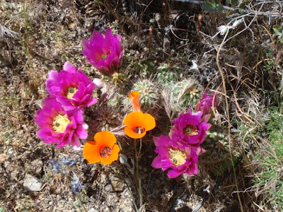
 I would like to be here at blooming time to see the flowers on the tip of the arm on the ground !
 How about this one, with the "crest" in it's center ?
 On we go .....
 Saguaro cactus and sycamore tree in Reavis Trail Canyon
After the easy, gentle climb up through Reavis Trail Canyon, crossing the stream many times, and riding in the shade of the sycamore trees, it's time to "pay the piper"; Montana Mountain ! After interminable, steep switchbacks the trail tops out at approx. 5500 feet, about 2600 feet higher than Superior . Whew ! Poor Billy!
 Poor Billy almost to the top (looking east)
Forest Road 650 looked pretty good after that climb . A couple of miles on the road, walking in the shade of huge juniper trees, and we were in camp .

Our camp at Rogers Trough

Our camp at Rogers Trough
At this camp, in the evening, the dogs got "skunked". They had never seen a skunk and were fascinated by this slow, waddling little creature . We convinced it to move on, with some well targeted rocks . The dogs wanted sympathy from us but got " Don't come over near ME !" . The next day they had to ride in the back of the truck, instead of inside like the little princesses that they are .


No comments:
Post a Comment